Research
I would characterise my research as an equal mix of:
- GIS: preparing and crunching real-world datasets so that they can be used for spatial analysis;
- computational geometry: extending and adapting theoretical results to real-world problems;
- implementation: I strongly believe in implementing my research results, see my open-source software page.
CityJSON: CityGML without the GML mess

CityJSON is a format for encoding a subset of the CityGML data model using JavaScript Object Notation (JSON). A CityJSON file represents both the geometry and the semantics of the city features of a given area, eg buildings, roads, rivers, the vegetation, and the city furniture. The aim of CityJSON is to offer an alternative to the GML encoding of CityGML, which can be verbose and complex, and thus rather frustrating to work with. CityJSON aims at being easy-to-use, both for reading datasets, and for creating them. It was designed with programmers in mind, so that tools and APIs supporting it can be quickly built.
cjio: Python CLI to process and manipulate CityJSON files
Automatic reconstruction of 3D city models for CFD
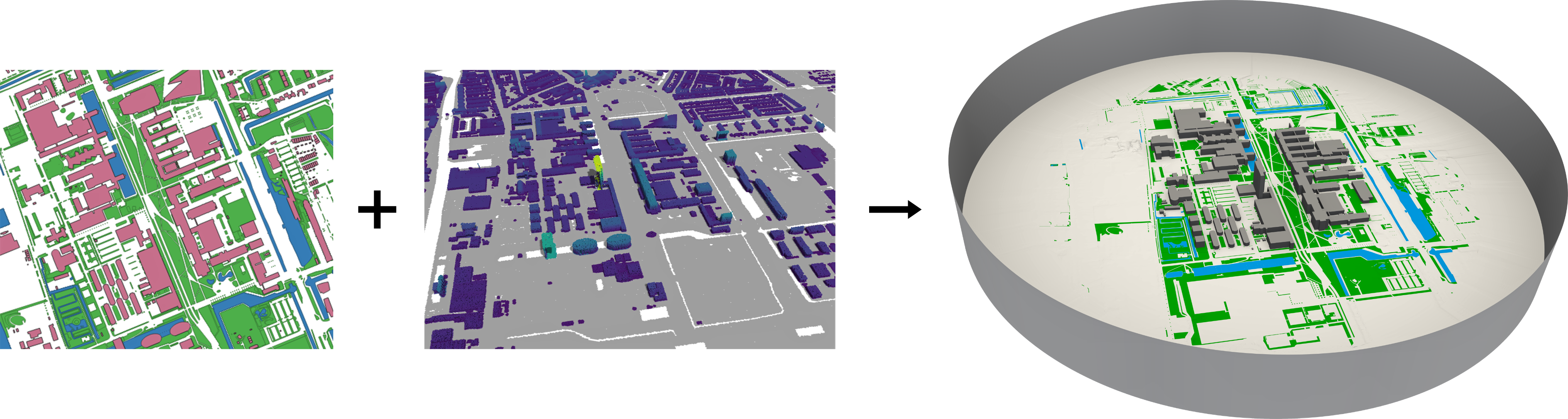
We develop methods and software to reconstruct 3D city models that are ready to be imported in OpenFOAM (this is Ivan Pađen’s PhD project, which I supervise with Clara García-Sánchez).
The open-source software City4CFD takes building footprints and a point cloud, and creates valid/watertight geometries that can be used for microscale urban flow simulations.
Article: Towards automatic reconstruction of 3D city models tailored for urban flow simulations
Segmentation of urban textured meshes
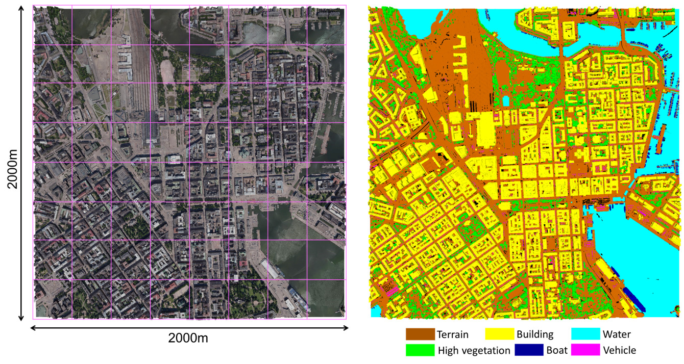
We develop algorithms and software to semantically segment very large urban textured meshes (this is Weixiao Gao’s PhD project, which I supervise with Liangliang Nan).
We have annotated part of the open Helsinki 3D dataset and released it as open dataset (code+dataset).
Our methodology outperforms other segmentation methods, see our two papers:
SUM: A benchmark dataset of Semantic Urban Meshes
PSSNet: Planarity-sensible Semantic Segmentation of large-scale urban meshes.
Validation & automatic repair of geo-datasets
A few years ago, out of frustration at the poor quality of GIS datasets and of 3D city models I obtained, I have focussed my efforts on the validation and the automatic repair of polygons and polyhedra. This has lead to different programs that have matured enough to not be called prototypes anymore: prepair, pprepair and val3dity. I hope these will help practitioners who often spend hundreds of hours manually repairing their datasets.
Validation of 3D geometries as a web-application.
Some other research projects (completed)
- UMnD: Urban modelling in higher dimensions
- iNous: Building an Eco-System for Indoor Spatial Information
- Point cloud modelling with the 3D MAT
- 3D4EM: Design and implementation of an SDI for integrated environmental modelling in 3D
- GeoBIM: Bridging the gap between Geo and BIM
- Automatic generation of semantic 3D city models from 3D textured meshes
- 5D geo-modelling
- Automatic reconstruction of simulation-ready 3D city models
- FieldGML: a GML-based representation for fields in 2D and 3D, my attempt at improving ISO19123, the standard for coverages
- Modelling geoscientific data with the 3D Voronoi diagram: my PhD thesis on the topic.