Two journal papers on 4D and nD object manipulation and visualisation
Jul 3, 2017
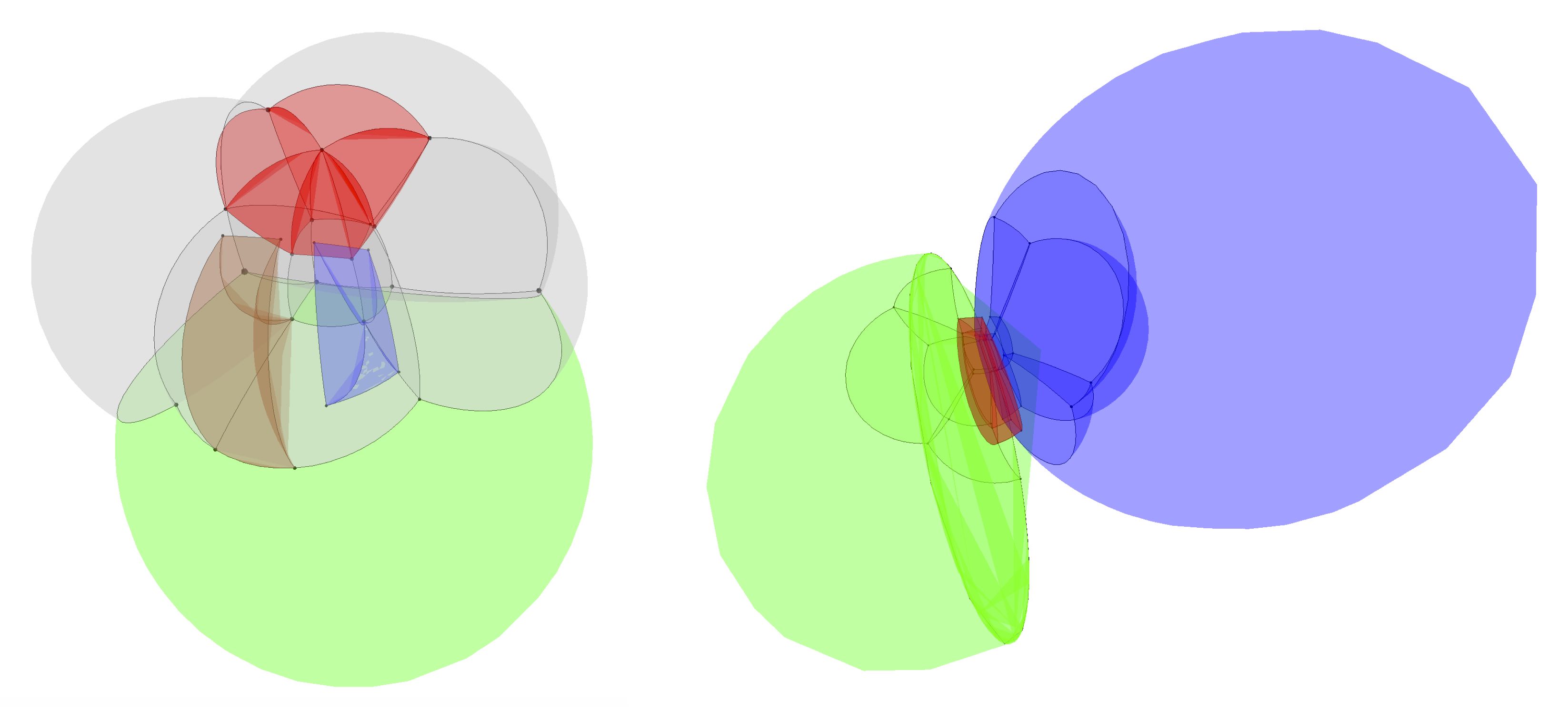
We recently had two related journal papers published. The first of these deals with how to create and manipulate nD representations of geographic objects. The second shows a few different ways in which such objects can be visualised. Both of them were published in open access journals, so anyone can access them!
Visualising higher-dimensional space-time and space-scale objects as projections to R3. Ken Arroyo Ohori, Hugo Ledoux and Jantien Stoter. PeerJ Computer Science, July 2017. ISSN: 2376–5992.
DOI BibTeX
DOI BibTeX
@article{Arroyo-Ohori17a,
	author = {Ken {Arroyo Ohori} and Hugo Ledoux and Jantien Stoter},
	journal = {PeerJ Computer Science},
	month = {jul},
	note = {ISSN: 2376--5992},
	title = {Visualising higher-dimensional space-time and space-scale objects as projections to {R3}},
	year = {2017}
}
Modelling and manipulating spacetime objects in a true 4D model. Ken Arroyo Ohori, Hugo Ledoux and Jantien Stoter. Journal of Spatial Information Science 14, June 2017, pp. 61–93. ISSN: 1948–660X.
DOI BibTeX
DOI BibTeX
@article{Arroyo-Ohori17,
	author = {Ken {Arroyo Ohori} and Hugo Ledoux and Jantien Stoter},
	journal = {Journal of Spatial Information Science},
	month = {jun},
	note = {ISSN: 1948--660X},
	pages = {61--93},
	title = {Modelling and manipulating spacetime objects in a true {4D} model},
	volume = {14},
	year = {2017}
}