Journal paper on the skeleton-based automatic identification of watercourses from LiDAR point clouds
Jun 15, 2017
We published a new paper in the journal Computers & Geosciences.
PDF DOI BibTeX
@article{Broersen17,
	author = {Tom Broersen and Ravi Peters and Hugo Ledoux},
	journal = {Computers & Geosciences},
	pages = {171--180},
	title = {Automatic identification of watercourses in flat and engineered landscapes by computing the skeleton of a LiDAR point cloud},
	volume = {106},
	year = {2017}
}
Abstract
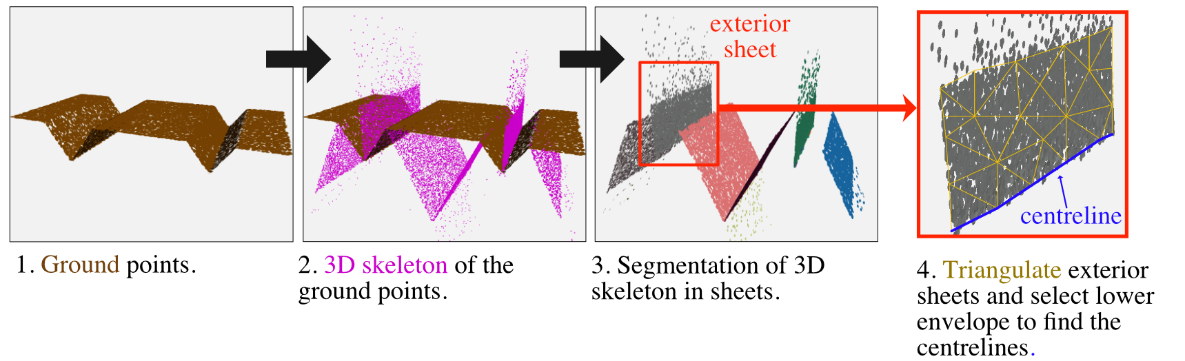
Drainage networks play a crucial role in protecting land against floods. It is therefore important to have an accurate map of the watercourses that form the drainage network. Previous work on the automatic identification of watercourses was typically based on grids, focused on natural landscapes, and used mostly the slope and curvature of the terrain. We focus in this paper on areas that are characterised by low-lying, flat, and engineered landscapes; these are characteristic to the Netherlands for instance. We propose a new methodology to identify watercourses automatically from elevation data, it uses solely a raw classified LiDAR point cloud as input. We show that by computing twice a skeleton of the point cloud — once in 2D and once in 3D — and that by using the properties of the skeletons we can identify most of the watercourses. We have implemented our methodology and tested it for three different soil types around Utrecht, the Netherlands. We were able to detect 98% of the watercourses for one soil type, and around 75% for the worst case, when we compared to a reference dataset that was obtained semi-automatically.