High-Resolution Urban CFD Simulations and Measurements for Urban Air Mobility
The 3D Geoinformation research group is looking for a postdoc to work in the intradisciplanary project IAM-CC (https://www.iamcc.eu/). You will explore the reconstruction of urban environments tailored for CFD simulations to develop Urban Air Mobility risk maps an validate them with field measurements. The work includes reconstruction, simulation and measurement tasks.
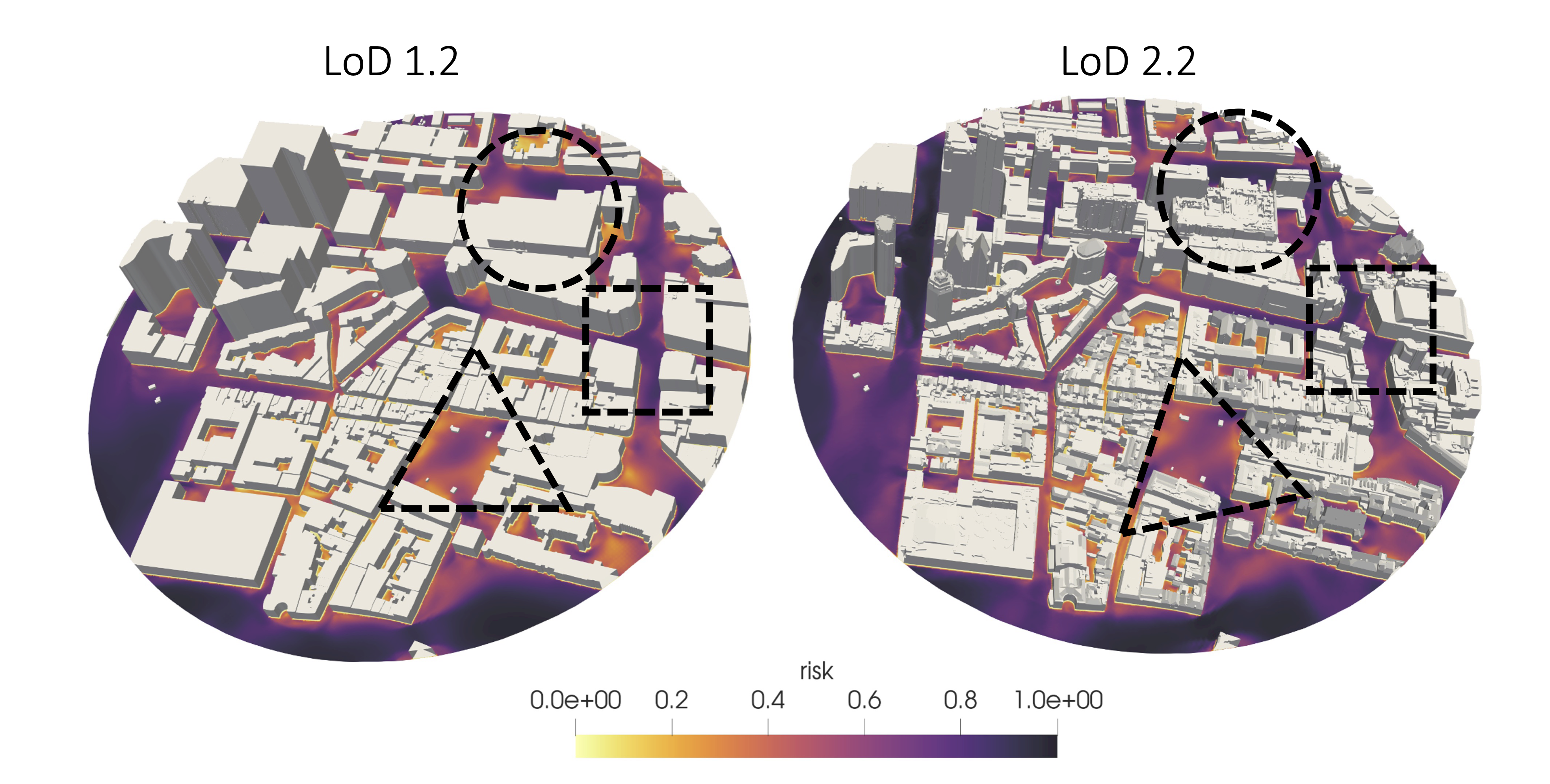
Urban environments present complex aerodynamic challenges. The growth of Urban Air Mobility creates new demands for understanding wind patterns, turbulence and UAM downwash in densely built areas. In this position, you will develop and apply methodologies that combine urban reconstruction, high-resolution CFD simulations and field measurements to improve the accuracy and reliability of urban flow predictions.
Your research will focus on:
- Reconstructing urban environments at different levels of detail for CFD applications.
- Performing CFD simulations of urban airflow including UAM downwash effects.
- Developing and applying workflows for three major European cities: Milan, Coimbra and Madrid.
- Conducting and analysing on-site wind field measurements during project living labs, including UAM flight demonstrations in Milan.
- Validating numerical predictions using real-world measurement data.
- Collaborating with researchers and industry partners within the IAM-CC consortium.
- Publishing research findings in leading scientific journals and conferences.
Research group
The position will be embedded in the 3D geoinformation research group, Section Urban Data Science part of the Faculty of Architecture and the Built Environment. The group focuses on technologies underpinning open geo-data and the integration with Building Information. Models and aims at designing, developing, and implementing open data and open source solutions to model cities, buildings, and landscapes in 3D for environmental and urban studies. Open Science is an important principle of our research. We also provide education in the MSc Geomatics. It is a multidisciplinary group of about 25 people, including computer scientists, geomatics engineers, and geographers. It has a history of successful collaborations with the industry and the government: its research has led to software, standards and patents for the management of 3D geographic information.
The researcher will be part of the IAM-CC project, funded by the European Union, in which we will collaborate with experts in UAM, urban planning, noise and decision making at various, research organizations, municipalities and companies.
Job requirements
- Holds a PhD degree (or almost completed) in aerospace engineering, mechanical engineering, geoinformatics/geomatics, computer science, applied mathematics, or in a related engineering discipline.
- Has experience in computational fluid dynamics, machine learning, 3D modelling, preferably from a programming perspective.
- Has good software development skills. Experience with C++ is beneficial.
- Has excellent oral and written communication skills. See requirements at TUDelft.
- Has an affinity with working in multi‐disciplinary teams in an international oriented environment.
What we offer
- Salary and benefits are in accordance with the Collective Labour Agreement for Dutch Universities. The salary is min. €3.546,- to max. € 5.538,- gross per month. Besides the salary you also receive an annual holiday payment of 8% and an end of year bonus payment of 8.3%.
- The position has a fixed-term contract of 2 years.
- The TU Delft offers a customisable compensation package, a discount on health insurance and sport memberships, and a monthly work costs contribution. Flexible work schedules can be arranged.
- For international applicants we offer the Coming to Delft Service and Partner Career Advice to assist you with your relocation. An International Children’s Centre offers childcare and there is an international primary school.
How to apply
You can apply via this webpage
To apply, please submit:
- A detailed CV.
- A motivation letter (max 1 page) explaning your interest in the research topics to be addresses and describing how you fit in the advertised position.
- PhD (draft) and MSc thesis, and one notable publication you have authored.
- Contact details of two refereces (recommendation letters from them are not required at this stage).
For more information about this position, please contact directly dr Clara Garcia-Sanchez.