Geomatics students present their impressive project results on 3D reconstruction of roof details and 3D data for air quality calculations
Jul 9, 2019
During Q4 of the first year of the MSc Geomatics we as a group supervised 2 of the 4 groups of the Synthesis project. Within the Synthesis project the students gain 10ECTS by performing a project in the way it works on the job. All subjects have a client from practice with a real-world problem they want to see solved. The research is looking at state-of-the-art and based on this the students work on solutions for their client’s problem. In the end all groups presented the end product to experts in the field during the Geomatics day.
Project ‘3D reconstruction of roof details’
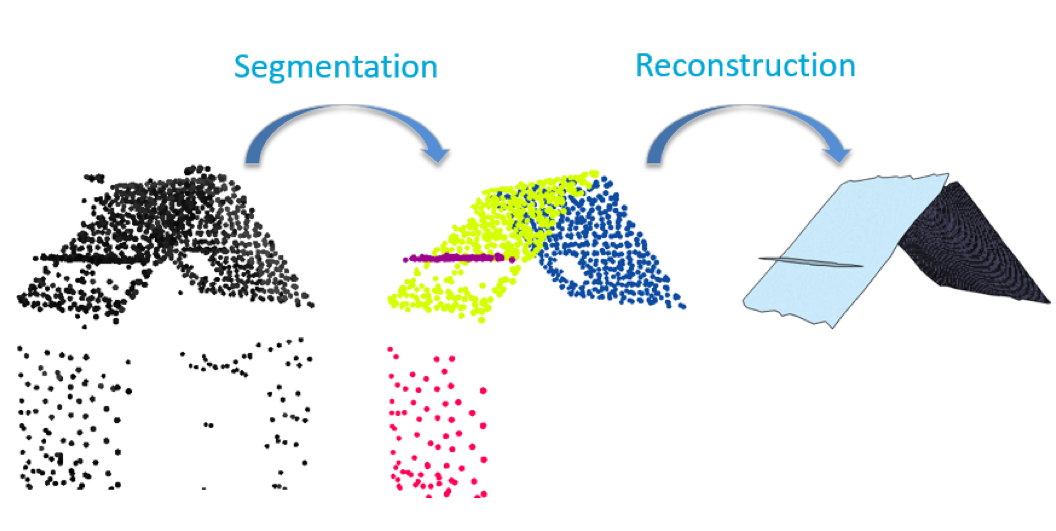
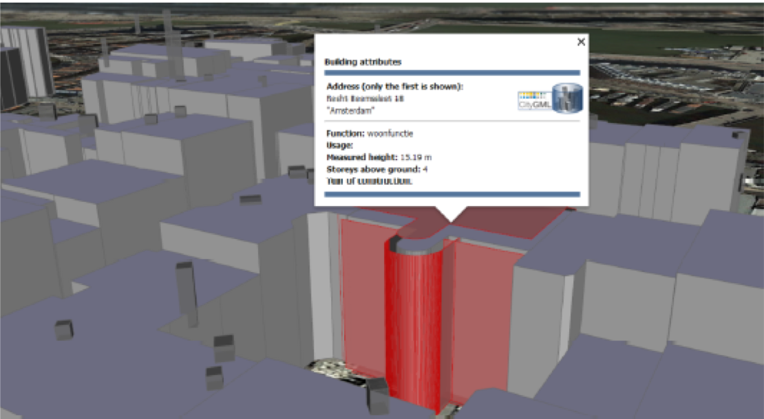
The client for this project was the Municipality of Amsterdam. The main challenge of this project was that, currently, it is complicated to check and enforce the chimney regulations for restaurants in the city. Currently the height of the chimneys is measured by inspectors on-site, which may result in inconsistent measurements and time consuming practices. Therefore, a faster, automated and possibly scalable method was required. In the first part of the project, the students generated and enriched a CityGML-based city model of the study area in the city centre of Amsterdam using exclusively existing spatial and non-spatial data. Specifications of the to-be-built city model were delivered at the beginning of the project. Buildings were characterised in terms of building usage, year of construction, etc. integrating and harmonising heterogeneous datasets. The second part of the project was focused on developing an application, based on the 3D city model previously obtained, to identify and check whether chimneys of buildings used as restaurants are complying with the current safety regulations in terms of minimum height from the underlying roof surface. A fully automated and reliable way to identify chimneys could not be obtained at the end of the project, mainly due to the still too low resolution of the input point clouds used for the building reconstruction. However, the results were used to provide suggestions on what would be needed in terms of data to obtain city-wide acceptable results. Shortcomings in the current data were identified, and some suggestions were elaborated drawing on the lessons learned during the project.
 |
 |
Project ‘Influence of 3D City Layout on AirQuality’
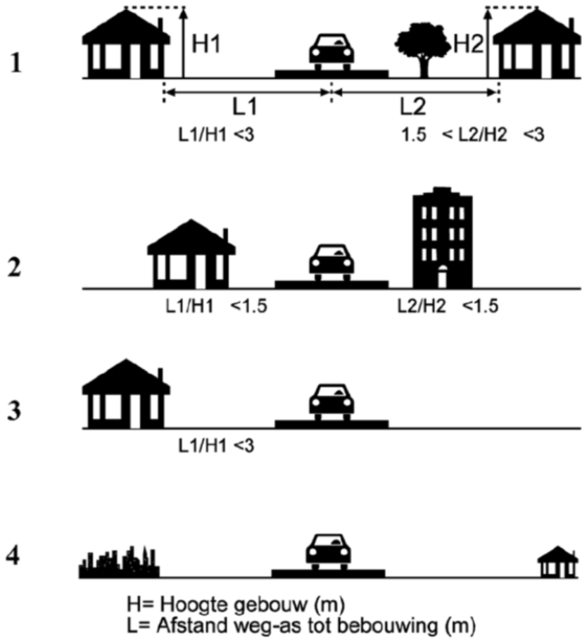
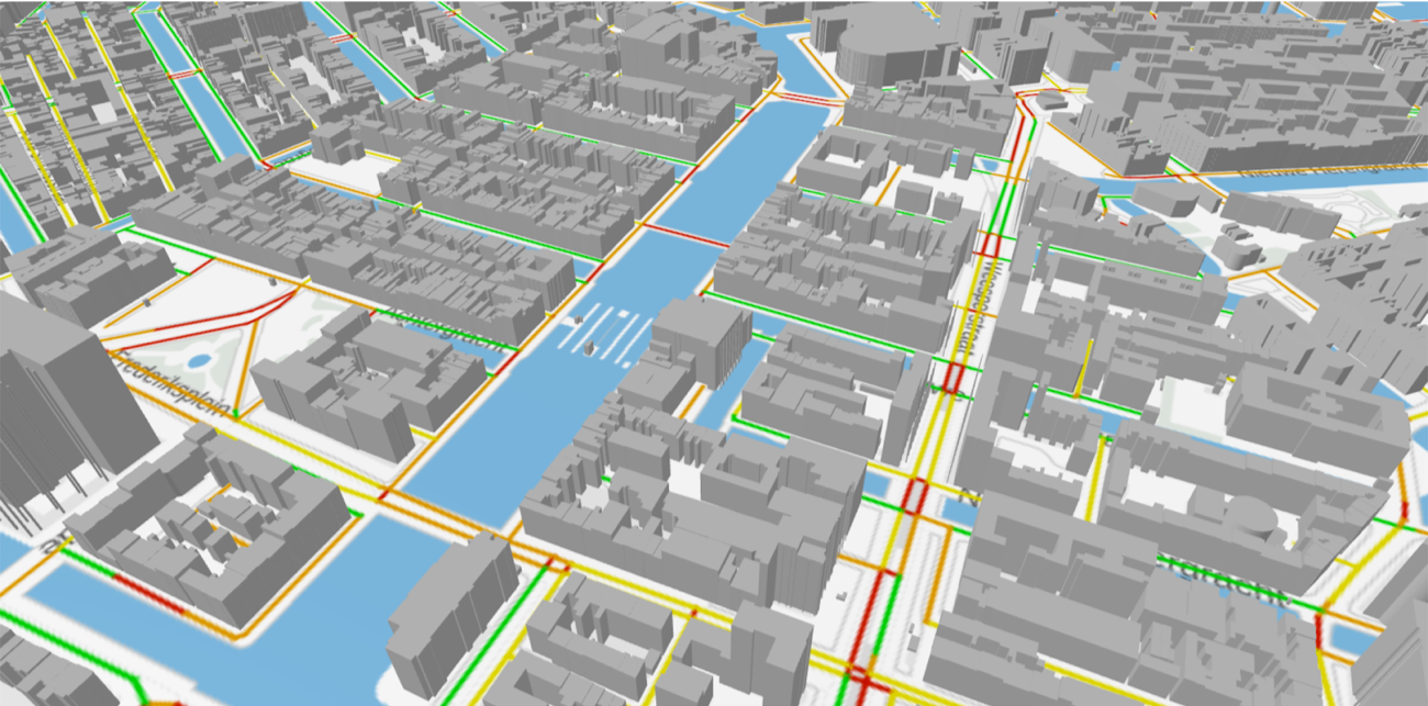
The client for this project is the Dutch National Institute for Public Health and the Environment (RIVM). RIVM maintains a standardised calculation method to estimate air pollution produced by traffic in urban areas. This method makes use of a street classification based on distance between buildings and roads and the height of these buildings (see figure below left). This street configuration determines different dilution levels for the pollutants, and consequently how much of the polluted air will stagnate between the buildings (with higher pollutant concentrations as consequence). At this moment, only the largest cities and towns (~40) collect the street types manually and can thus provide information on air pollution produced by traffic. The students have implemented an algorithm in which they showed that the automated classification of street configuration based on 3D building models is indeed possible for most of the situations (figure below right). With their algorithm, they can reconstruct countrywide input data on street types as needed for the air quality model, thus allowing to perform the calculation at national scale. In further work the algorithm can be improved to also address exceptional urban situations. In addition, the students performed field measurements in Amsterdam to study a possible pattern relation between the street types and the air pollution measured in the field. This part of the project needs further work and data to obtain a better understanding of the possible correspondence.
 |
 |