Spatial subdivision of complex indoor environments for 3D indoor navigation
Sep 28, 2017
A new paper has been published:
PDF DOI BibTeX
@article{Diakite18spatial,
author = {Abdoulaye A. Diakité and Sisi Zlatanova},
title = {Spatial subdivision of complex indoor environments for 3D indoor navigation},
journal = {International Journal of Geographical Information Science},
volume={32},
number={2},
pages={213--235},
year  = {2018},
publisher = {Taylor & Francis},
doi = {10.1080/13658816.2017.1376066},
URL = {http://dx.doi.org/10.1080/13658816.2017.1376066},
eprint = {http://dx.doi.org/10.1080/13658816.2017.1376066}
}
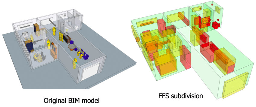
As we realize that we spend most of our time in increasingly complex indoor environments, applications to assist indoor activities (e.g. guidance) have gained a lot of attention in the recent years. The advances in ubiquitous computing made possible the development of several spatial models intending to support context-aware and fine-grained indoor navigation systems. However, the available models often rely on simplified representations (e.g. 2D plans) and ignore the indoor features (e.g. furniture), thereby missing to reflect the complexity of the indoor environment. In this paper, we introduce the Flexible Space Subdivision framework (FSS) that allows to automatically identify the spaces that can be used for indoor navigation purpose. We propose a classification of indoor objects based on their ability to autonomously change location and we define a spatial subdivision of the indoor environment based on the classified objects and their functions. The framework can consider any 3D indoor configuration, the static and dynamic activities it hosts and it enables the possibility to consider all types of locomotion (e.g. walking, flying, etc.). It relies on input 3D models with geometric, semantic and topological information and identifies a set of subspaces with dedicated properties. We assess the framework against criteria defined in previous researches and we provide an example.
The outcome of this paper stands as a milestone in the NWO/M4S SIMs3D project that is aiming to provide support for advanced navigation in context of emergency in large buildings. The paper is available at the IJGIS journal’s website (open access).
