Polished code

2D Polygon repair
This CGAL package provides algorithms to repair 2D polygons, polygons with holes, and multipolygons with holes, by selecting faces of the arrangement of the input based on a selection rule. The even-odd rule and the non-zero rule are provided for dealing with self intersections. The union and the intersection rule enable to combine similar polygons.

azul
azul is a 3D city model viewer for macOS. It is intended for viewing 3D city models in CityGML 1.0 and 2.0, CityJSON 1.0 and 1.1, IndoorGML, OBJ, OFF and POLY. It supports loading multiple files, selecting objects by clicking them or selecting them in the sidebar, toggling the visibility of individual items, and browsing their attributes. It is research software, but it is pretty stable and most datasets already work without problems. It is available under the GPLv3 licence.
Read more:
@article{20tgis_azul,
	author = {Ken {Arroyo Ohori}},
	journal = {Transactions in GIS},
	month = {oct},
	note = {ISSN: 1467--9671},
	number = {5},
	pages = {1165--1184},
	title = {{a}zul: a fast and efficient {3D} city model viewer for {macOS}},
	volume = {24},
	year = {2020}
}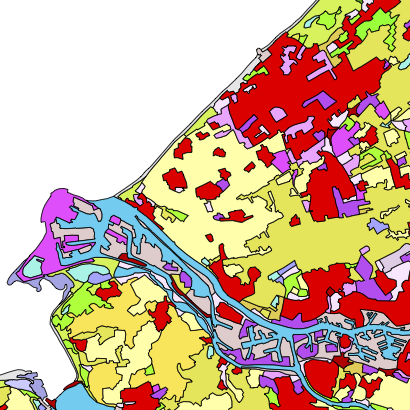
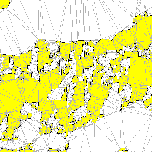
pprepair
(planar partition repair) ensures that a set of polygons form a valid planar partition, made of valid polygons and having no gaps or overlaps.
Read more:
@article{12pfg,
	author = {Ken {Arroyo Ohori} and Hugo Ledoux and Martijn Meijers},
	journal = {Photogrammetrie, Fernerkundung, Geoinformation},
	month = {oct},
	note = {ISSN: 1432--8364},
	pages = {613--630},
	title = {Validation and Automatic Repair of Planar Partitions Using a Constrained Triangulation},
	volume = {5},
	year = {2012}
}
prepair
(polygon repair) takes a possibly invalid polygon, gives it a consistent interpretation and returns a valid polygon according to the OGC Simple Features and ISO 19107 rules.
Read more:
@article{14cg,
	author = {Hugo Ledoux and Ken {Arroyo Ohori} and Martijn Meijers},
	journal = {Computers \& Geosciences},
	month = {may},
	note = {ISSN: 0098--3004},
	pages = {121--131},
	title = {A triangulation-based approach to automatically repair {GIS} polygons},
	volume = {66},
	year = {2014}
}
Some useful bits and pieces
- isochrones-mexico: Compute isochrones from GTFS data and display them in an interactive map
- konturpop: Estimate urban populations from the Kontur population dataset
- osmium-buildings: Count OSM buildings using the Osmium library
- elevador: Create 3D city models from a 2D map and a point cloud
- osclassifier: Classify Ordnance Survey MasterMap data into CityJSON classes
- azul4d: Visualisation of 4D objects using Metal
- lcc-tools: tools I developed during my PhD to construct and manipulate higher-dimensional linear cell complexes, such as incremental and non-incremental construction and extrusion
- TriVis: small Mac visualiser to debug triangle-based algorithms
- cgal-etc: (enhanced triangulation classes) add functionality to CGAL triangulations, such as labelling edges and removing constraints
- imbiber: converts BibTeX to HTML using Ruby, includes a Jekyll plug-in
- bibhtmler: converts BibTeX to HTML using PHP