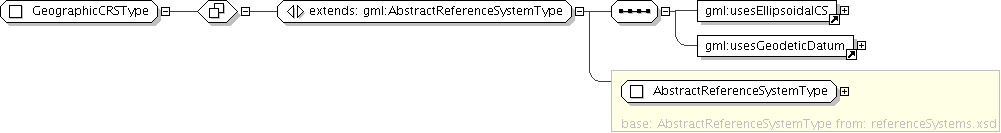
Documentation for fieldgml

Complex Type: GeographicCRSType

[Table of contents]

Super-types: gml:AbstractReferenceSystemType < GeographicCRSType (by extension)
Sub-types: None
Name GeographicCRSType
Abstract no
Documentation A coordinate reference system based on an ellipsoidal approximation of the geoid; this provides an accurate representation of the geometry of geographic features for a large portion of the earth's surface.
XML Instance Representation
<...
gml:id="[1]">
<gml:srsName> ... </gml:srsName> [1]
<gml:srsID> ... </gml:srsID> [0..*]

'Set of alterative identifications of this reference system. The first srsID, if any, is normally the primary identification code, and any others are aliases.'

<gml:remarks> ... </gml:remarks> [0..1]

'Comments on or information about this reference system, including source information.'

<gml:validArea> ... </gml:validArea> [0..1]
<gml:scope> ... </gml:scope> [0..1]
</...>
Diagram
Schema Component Representation
<complexType name="GeographicCRSType">
<complexContent>
<extension base=" gml:AbstractReferenceSystemType ">
<sequence>
<element ref=" gml:usesEllipsoidalCS "/>
<element ref=" gml:usesGeodeticDatum "/>
</sequence>
</extension>
</complexContent>
</complexType>