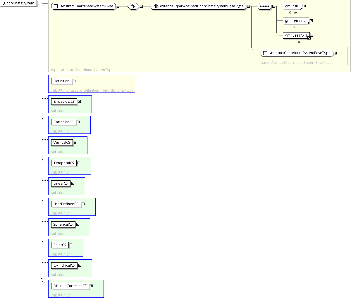
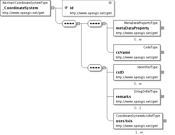
Documentation for fieldgml

Element: _CoordinateSystem

[Table of contents]

Name _CoordinateSystem
Type gml:AbstractCoordinateSystemType
Nillable no
Abstract yes
Logical Diagram
XML Instance Representation
<gml:_CoordinateSystem
gml:id="[1]">
<gml:metaDataProperty> ... </gml:metaDataProperty> [0..*]
<gml:csName> ... </gml:csName> [1]
<gml:csID> ... </gml:csID> [0..*]

'Set of alternative identifications of this coordinate system. The first csID, if any, is normally the primary identification code, and any others are aliases.'

<gml:remarks> ... </gml:remarks> [0..1]

'Comments on or information about this coordinate system, including data source information.'

<gml:usesAxis> ... </gml:usesAxis> [1..*]

'Ordered sequence of associations to the coordinate system axes included in this coordinate system.'

</gml:_CoordinateSystem>
Diagram
h1723224726 h-1962572997 h-1471849131 h-1351776343 h-152286123 h-1775700904 h667453579 h72100522 h-632409653 h1911486267 h-594538102
Schema Component Representation
<element name="_CoordinateSystem" type=" gml:AbstractCoordinateSystemType " abstract="true" substitutionGroup="gml:Definition"/>