Thesis starting September 2023

Rianne Aalders
Exploring the design of a ‘coordinating’ data governance model for the green village at the TU Delft

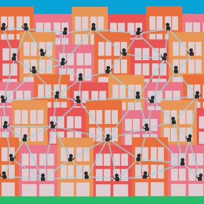
The primary thought behind this research is: How can data be used for good in a tech driven urban environment? Richard Sennett speaks in his book ‘Ethics for the City’ of a ‘coordinating smart city’ a framework for a preferable relationship between citizens, technology, and the city. In contrast to a ‘prescriptive smart city’ that limits the agency of its citizens.

In my thesis I will apply this framework to The Green Village (TGV), a living lab for sustainable innovations located on the TU Delft campus to answer the questions: 1. What is a coordinating smart city according to Sennett and other literature? 2. To what degree are TGV and living labs smart cities? 3. To what degree is TGV a smart city? 4. How can the framework of the coordinating smart city be applied to a real life urban environment? 5. And How can the framework of the coordinating smart city be expanded upon, based on its application to TGV?

For this exploratory research, Sennett’s writing and other literature will be further studied to unpack the coordinating smart city. Then, in a case study of TGV, including interviews with the parties involved both the people managing TGV and its inhabitants, the framework will be applied and tested.

Supervisors: Stefano Calzati + Hendrik Ploeger
Simay Batum
Comparing CityGML and IFC encodings of LADM Part 5 Spatial Plan Information to support Permit checking – Case Study Estonia

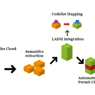
The thesis primarily investigates the integration of the Land Administration Domain Model (LADM) into 3D building models encoded in CityGML and IFC. It focuses on enhancing semantic interoperability and efficiency by incorporating LADM, using automated permit checks in Estonia as a case study. The research aims to assess the feasibility and benefits of integrating LADM into existing 3D building models, with permit checking efficiency as another focus under the case study. With this research, broader implications for improving the accuracy and effectiveness of land administration systems and 3D modeling for urban development are envisioned.

Supervisors: Peter van Oosterom + Eftychia Kalogianni
(company involved: Future Insight, Rick Klooster)

Gees Daniël Brouwer
Analyzing Coral Reef Complexity: Geoinformation Tools in Assessing Biodiversity and Health

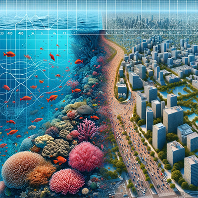
This MSc thesis focuses on spatially characterizing coral reef communities using urban geoinformation tools. The primary aim is to understand the relationship between coral reef health and their spatial characteristics. To enhance the accuracy of fluid dynamics simulations for assessing coral reef health, a deeper understanding of the spatial characteristics of coral reefs is essential, especially in the context of simulated reef environments. This research is crucial due to the declining global health of coral reefs, largely attributed to ocean acidification!

Supervisors: Akshay Patil + Hugo Ledoux

Mengying Chen
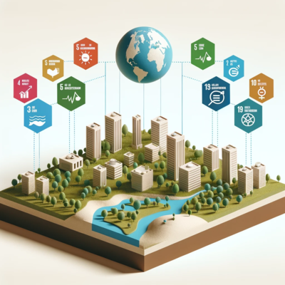
Assessing the Impact of 3D Land Administration Systems Based on ISO 19152 LADM in Achieving Sustainable Development Goals

The 2030 Agenda for Sustainable Development is a global initiative endorsed by UN member States to address various aspects of sustainability, including people, the planet, prosperity, peace, and partnership. It includes the implementation of the Sustainable Development Goals (SDGs), which consist of 17 Global Goals to be achieved over a 15-year period. Within this agenda, there are land-related targets and indicators aimed at promoting responsible land governance.

Land administration plays a crucial role in connecting individuals to land and providing information on land tenure, land use, land value, and land development. Land Administration Systems (LAS) based on the ISO 19152 Land Administration Domain Model (LADM) serve as the foundation for recording a complex range of rights, restrictions, and responsibilities related to people, policies, and places. LAS, especially those based on ISO 19152 LADM, are essential drivers toward a sustainable economy and society.

The objective of this MSc thesis is to delve into SDGs targets and indicators that can be used to assess the added value of 3D Land Administration Systems based on LADM. The possibility of using Madaster or forest Rights, Restrictions, and Responsibilities (RRRs) as case studies will also be considered.

Supervisors: Eftychia Kalogianni + Peter van Oosterom

Susanne Epema
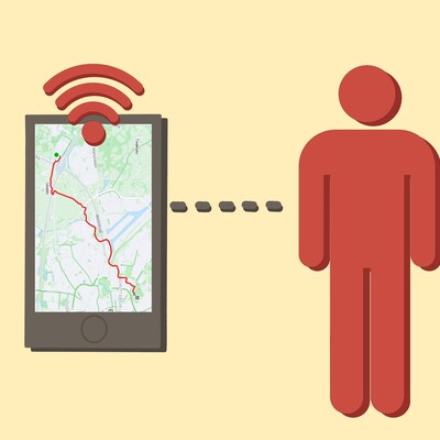
The technology-user interaction: Exploring the discrepancy between intended and actual use of a geo-data collecting application, data practices and user control. (Strava case study)

Strava is an exercise self-tracking app initially designed for running and biking routes, and boasts a social component encouraging users to engage with communities, connect to other exercise-enjoyers, and share their activities. Strava therefore collects geoinformation from its users, tracking its routes for distance covering and comparison to other users on specific segments. This thesis aims to investigate the difference between the use of the app envisaged by the developers and the actual use. It researches what data is being collected and how this data is being utilized, and how the user tries to regulate the data they contribute to this application. It investigated how representative the image of the user based on the data of this app is. The methodology includes a literary review, employs autoethnography to gain firsthand experience into the user experience, and interviews with users of the app. The results describe evidence in the two-way technology-user interaction and would have findings on the representation of the user within the app.

Supervisors: Hendrik Ploeger + Stefano Calzati
Yingxin Feng
User-guided geometrical editing of high-quality 3D models

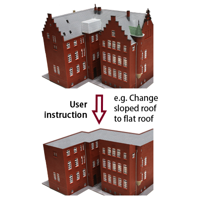
Editing 3D models’ geometry is an important but time-consuming task for architectural designers. The emergence of generative AI methods that enable user-guided model editing brings about new possibilities. However, the current methods still perform unsatisfactorily when dealing with high-quality details and strong changes, which hinders its further appliance. Therefore, the thesis will focus on developing a generative tool that allows users to make significant changes to complex 3D models with easy instructions and obtain geometric-aligned results. Experiments will be made with multiple model architectures and different tricks based on the literature review to find a relatively precise and efficient solution. The major elements of the tool include 3D representation, generative models, and datasets. Implicit signed distance function and explicit mesh-based or point cloud representation are possible options for details preservation. To fully leverage the existing research, pre-trained open-source 2D diffusion models will be chosen for loss calculation. For other steps, models will be obtained from open 3D datasets like DTU. Additionally, tricks like latent space extraction, camera pose and positional encoding, loss functions’ combination, etc. will be tested.

Supervisors: Nail Ibrahimli + Ken Arroyo Ohori

Sicong Gong
Integrating the trajectories of moving objects into OLAP systems

With the popularization of mobile Internet of Things (IoT) applications, massive amounts of various spatiotemporal data are emerging, collected and stored. Among them, trajectory data, such as Global Positioning System (GPS) data and mobile phone data, is uniquely valuable because of the large amount of information it contains. Currently, the utilization and reproduction (added-value extraction) of trajectory data is still limited by its huge size and complex structure.

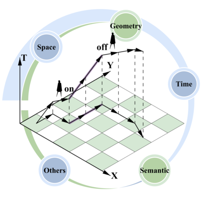
Data Warehouse (DW), compared with traditional Database Management System (DBMS), is tuned for Online analytical processing (OLAP) answering multi-dimensional analytical queries swiftly in computing. Trajectory data inherently contains multiple dimensions, including time, space, semantics, and more making it possible for Data Cube-based OLAP technology to optimize query performance. However, traditional OLAP systems support only numeric measurements and do not accommodate spatial data types like Simple Feature Specification (SFS).

This project aims to abstract, organize, and integrate various dimensions of trajectory data into OLAP systems.

Supervisors: Dr.Ir. Martijn Meijers + Drs. Wilko Quak

Tessel Elisabeth Kaal
Optimization of Buildings Energy Demand-Supply for Local Energy Source Design with Minimum Burden on the Grid

The overarching theme of this thesis, under the umbrella of DATALES, is the optimization of energy demand and supply in buildings with an emphasis on local energy sources to minimize the burden on the central grid.

The essence of the DATALES lies in its focus on integrating numerous distributed energy resources (DERs). The project aims to unlock the potential of local energy systems (LESs) and green buildings in urban areas by developing a data-driven operational paradigm. The DATALESs comprises six Work Packages. The faculty Architecture is involved in Work Package 3: Data-driven green building modelling and energy management.

This thesis addresses the data-driven modelling, by researching the complex balance between energy consumption and production in urban structures. By utilizing optimization techniques, the study aims to develop strategies for efficiently managing and using energy resources at a local level, and to minimize the burden on the centralized power grid. Within the research innovative solutions are explored to enhance the energy efficiency of buildings, incorporating elements of renewable energy sources, smart grid technologies, and demand-side management.

Previous practices, in collaboration with Geodan, inform the study and are visualized through a digital twin. Accenture’s involvement during this thesis allows access to more data, facilitating testing of the optimization approach on real-life data.

Supervisors: Azarakhsh Rafiee + Martijn Meijers
(company involved: Accenture, Sanne Veringa)

Gabriela Koster
Designing a Dutch building energy simulation tool in a GIS environment

There is a current emphasis on reducing residential energy consumption in the Netherlands, with household thermal energy accounting for a significant portion. Building energy simulations play a crucial role in informed decision-making for design, payback calculations, and identifying cost-effective renovation measures. However, existing tools are either too detailed for municipal-level modeling or oversimplified on a national scale. The aim of this research is to look at creating a framework for constructing a theoretical thermal energy model based on existing NTA 8800 principles, compatible with semantic 3D city models.

Supervisors: C. León-Sánchez + Dr. G. Agugiaro

Stein Köbben
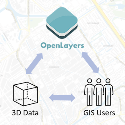
Integrating 3D into a 2D OpenLayers based online GIS

The thesis will be about integrating 3D functionalities into an existing Openlayers based web application, specifically Tailormap which is made by B3Partners. This means allowing users to publish their 3D datasets alongside the existing 2D maps and using the functionalities in the application. The research will be about how to make it useful for the users: What kind of data sets do they need to be able to publish, what options do they need, and how can it be easy to use without too much expert knowledge. The research question could be something like: ‘How can 3D functionalities be integrated into an existing GIS web application in a useful and easy to use way?’. There will a technical aspect to this: What will the data workflow look like, and how can 3D be integrated into the existing functionalities. There will also be an aspect of research into what the current needs of GIS users are for publishing 3D data.

Supervisors: Martijn Meijers + Eftychia Kalogianni
(company involved: Erik Meerburg)

Sitong Li
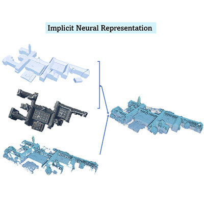
Enhancing 3D City Models with Neural Representations

The traditional 3D space representation methods like mesh, voxel and point cloud are explicit and discrete. They suffer from early, heuristic reduction of the triangulated 3D point cloud to an explicit height field or surface mesh. In this thesis, student will explore the generative possibility of implicit nueral representation to create enhanced 3D city model from a continuous occupancy field, driven by learned embeddings of the point cloud and a stereo pair of ortho-photos. The methodology entails a comprehensive approach beginning with data collection by extracting points from 3D BAG and Zurich city models for training, utilizing AHN3 point clouds as test data, and evaluating accuracy against AHN4 while visually inspecting discrepancies. Subsequently, data processing involves segmentation algorithms to isolate building points for higher performance, raising questions about learning a continuous occupancy field versus converting it into a CityGML 3D city model for practicality. Further exploration includes studying various Signed Distance Functions (SDFs) and Occupancy Networks, assessing their applicability in the project context, and initiating model development using the Convolutional Occupancy Network by Peng.

Supervisors: Nail Ibrahimli + Ken Arroyo Ohori

Na Liu
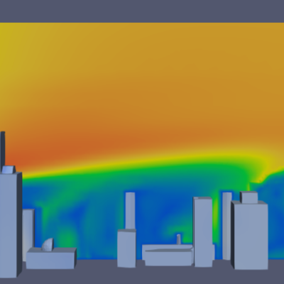
Using deep learning to simulate wind in building area

Wind simulation plays a crucial role across various fields and is applied under different context, as well as in building environment. The traditional method involves solving the computationally expensive Navier-Stokes equation, particularly challenging for detailed simulations in large areas like cities. Urban wind patterns depend heavily on city geometry, a critical factor in understanding airflow dynamics. While Computational Fluid Dynamics (CFD) simulations are considered the best practice, this study explores the potential of using deep learning as a surrogate model for faster and cost-effective wind simulations in building areas. The study’s central focus revolves around how effectively deep learning can simulate wind patterns in building areas using 3DBAG dataset. Objectives include applying deep learning models to simulate wind around buildings, assessing accuracy and computational efficiency compared to traditional methods, and examining factors like mesh settings and geometry types for optimization. The research may contribute insights into broader applications of deep learning in environmental modeling, aiming for faster and resource-efficient wind simulations in urban planning. The study seeks a comprehensive understanding of wind dynamics in building areas, further exploring the fusion of deep learning and environmental modelling.

Supervisors: Azarakhsh Rafiee + Frits de Prenter

Sharath Chandra Madanu
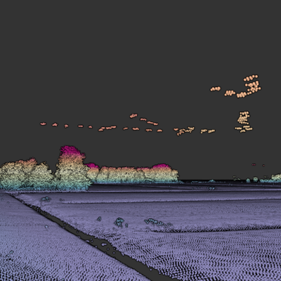
Identifying misclassifications in AHN using deep learning

Semantic classification of point clouds in 3D urban scenes is crucial for applications like urban planning and infrastructure management. Despite its importance, successful semantic classification of point clouds remains a challenging task. Currently, there exist many semantic errors in the existing classification (e.g., classification in AHN4 and AHN5). The major errors come from small-scale inconsistencies like outliers, ground points on top and middle of the building, etc. To remove such errors, in industry practice, separate algorithms have been developed to identify each specific error type. To this end, we see scope for automation using artificial intelligence, deep learning in particular.

In this project, we aim to refine the classification and remove errors using deep learning, to help automate the process by detecting and quantifying misclassifications. We will use AHN point cloud data, which is the current height model of the Netherlands. We will also use the point cloud data from Rijkswaterstaat and multi-spectral aerial imagery.

This thesis involves two key stages: data preprocessing, where AHN4 tiles undergo confidence scoring based on aerial imagery, NDVI, and BAG/BGT datasets; and online deep learning, where a model is trained on high-confidence samples to rectify errors and enhance predictions, with subsequent validation and testing for performance assessment. The emphasis is on simplicity for broad applicability to diverse projects.

Supervisors: Shenglan Du + Jantien Stoter

Dimitrios Mantas
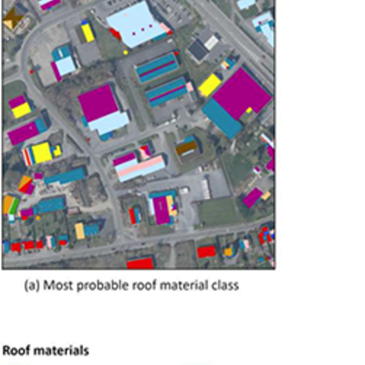
Enriching the 3DBAG with Roofing Material Types

The 3DBAG is an open building model dataset covering the entirety of the Netherlands. It is comprised of automatically generated, three-dimensional geometry at three levels of detail, namely 1.2, 1.3, and 2.2. Common use cases of the 3DBAG include energy demand, performance, and retrofitting applications; noise pollution studies; and wind flow and scalar dispersion simulations.

Geometric primitives in 3DBAG are documented with various semantic attributes including the roof type and elevation percentiles of the corresponding buildings. In this context, this thesis aims to enrich the dataset with a new label: the roofing material type, such as gravel, membranes, metal, sheets, slates, solar panels, tiles, and vegetation. This is expected to increase the overall value of 3DBAG by enabling more extensive and accurate architectural, engineering, and urban planning studies (e.g., neighbourhood uniformity, energy labelling, and urban heat island effect intensity assessments).

As such, roof surfaces in 3DBAG will be assigned a material type by employing state-of-the-art deep learning methods for supervised classification. This task will be carried out using a convolutional neural network architecture such as a residual network or its extensions. The novelty of this thesis lies in the choice of classification technique in combination with the fusion of true-colour or near infrared aerial orthophotos and the AHN4 point cloud for feature engineering.

Supervisors: Hugo Ledoux + Weixiao Gao

Ping Mao
A digital twin based on Land Administration

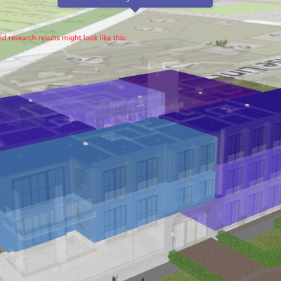
We work like an update of the physical building, the digital twin. But also, there is a need to update the legal space.

physical and legal representation Potential Expected Result 1:right inside a new building(private space, common space) show 3d objects + legal space(visualization example)

Potential Expected Result 2:Spatial Plan & Actual building Laws on the height of buildings(buildings fit in the plan or not fit in the plan) spatial plan is also a legal space Colored buildings are spatial plans, different colors are given to the buildings, different colors are for different functions, and different heights are set for different functions; grey buildings are buildings that already exist. It is possible to see which existing buildings are taller than the height set by the spatial plan.

Supervisors: Peter van Oosterom + Azarakhsh Rafiee

Sérénic Monté
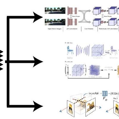
Centralized benchmark for MVS (Multi-View Stereo), neural mesh reconstruction, and NeRF-based novel-view synthesis

In my thesis I will focus on creating a benchmark that allows researches in the fields of Multiview Stereo (MvS), Novel View Synthesis (NVS), and Neural Surface Reconstruction (NSR) to compare their results with each other algorithms in their respective fields. These three fields require comparable input data, enabling us to create a benchmark for these three fields. The dataset we will use is a textured 3d building model, from this model we will create a set of images from different angles. Since we have a ground truth model we are able to evaluate the output of the different algorithms. By creating a standardized data set and evaluation metrics, it is easier to compare new algorithms to existing ones, the result should also become more fair, since the benchmark is the same for everyone. This could provide a better overview of the performance of different methods and making it easier to find possibilities for improvements in the field of novel images rendering even faster.

Supervisors: Nail Ibrahimli + Hugo Ledoux

Georgios Konstantinos Nestoras
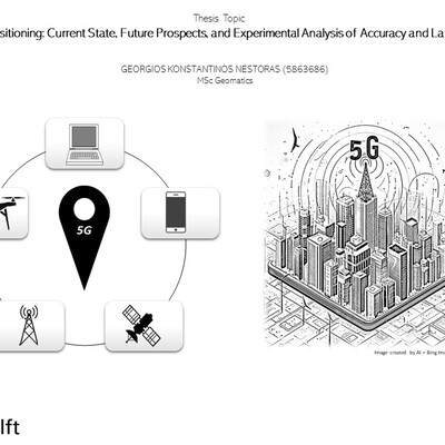
5G Positioning: Current State, Future Prospects, and Experimental Analysis of Accuracy and Latency

5G technology signifies a leap in connectivity with high-speed data, minimal latency, and transformative features. The main focus of this project is positioning for location-based services. 5G positioning provides real-time, accurate location data using advanced techniques. Led by Robert Voute (CGI) and supervised by Edward Verbree and Martijn Meiers (TU Delft), the project explores 5G positioning’s current state and future advancements. An Ericsson-facilitated experiment assesses 5G positioning accuracy and latency in real-world scenarios. Early 5G versions excel in position pinpointing using GPS and networks, enabling precise spatial info for applications. The project examines existing 5G positioning technology through literature review and system analysis. Anticipated developments in future 5G releases will be explored through a real-world experiment, aiming to bridge theory with practice and reveal insights into advantages and constraints. Acknowledging challenges like signal interference and network congestion, the project aims to refine and optimize 5G positioning. In conclusion, it aspires to contribute significantly to understanding and applying 5G positioning technology, serving as a resource in navigating the evolving landscape of location-based services in the 5G era.

Supervisors: Edward Verbree + Martijn Meijers
(company involved: Robert Voute)

Oliver Post
Developing a Framework for Parametric City Generation

The objective of this thesis is to design a framework for analysing real-world cities, with the goal of applying this analysis to stochastically and/or parametrically create computer-generated models of new cities.

This research will touch on the following areas:

  • Literature review into existing methods of urban landscape analysis and stochastic and parametric generation of city structure, road networks, points of interest distribution, building plot division and building generation with the aim to select a range of computable indicators.
  • Development of the analytical framework, incorporating automated techniques for extracting the specified indicators from real-world urban data.
  • Constructing an algorithmic pipeline to generate digital city models based on the framework analysis results.

The challenge of this topic lies in the complex nature of the urban environment, and the many factors that influence the shape and structure of cities.

The expected outcome of the thesis is a thorough analysis of the framework applied to various global cities and a software tool that can be used to generate digital city models based on a limited set of user inputs.

The generated city models can serve as inputs for built environment research such as wind and traffic simulations, aid in urban and architectural design, function as test data for digital formats, algorithms, and applications, provide training material for AI systems, and be used for virtual reality and video games.

Supervisors: Hugo Ledoux + Akshay Patil

Chengzhi Rao
Visualizing and rendering tiled 3D data on the Web

Vector-based maps, like the open-source Maplibre, have ben established s the de-facto standard in the industry for world-wide map data visualization.There is a robust tool chain for creating, styling and visualizing 2D data (through vector tiles) but no standardized way to do so in 3D. In this MSc thesis, it will investigate the possibity of interating (true) 3D Data in Maplibre, by potentially integrating an existing onen standard like 3D tiles to MapLibre GL JS. The topic will focused on the visualization part, by using WebGL to implement the 3D web mapping pipeline from the data creation all the way to the map rendering, extending MapLibre GL JS to incorporate some existing format, like 3D tiles.

This thesis is in collaboration with TomTom.

Supervisors: Ken Arrovo Ohori + Stelios Vitalis
(company involved: TomTom, Stelios Vitalis)

Puti Nabila Riyadi
Using 3D BAG to develop finite element models of buildings at regional scale

Enhancing the resilience of the built environment to disasters involves evaluating how buildings respond to external forces like earthquakes, subsidence, and landslides. Two key factors to be considered are the method of assessing the behaviour of the buildings and the availability of sufficient data about building geometries. Given the complexity of the interaction between structures, the ground, and external loading, a robust computational modelling using Finite Element Model is essential for predicting and simulating building behaviour. Hence, the simulation’s accuracy relies on obtaining comprehensive information about the physical characteristics of buildings, such as their structural elements. This data is vital for creating realistic models that can accurately represent the behaviour of structures under various external forces. This research will utilise the building geometries information from 3D BAG data.

The entire process of developing a model of a large number of buildings would be time-consuming, as developing one is challenging enough. Thus, the challenge lies in how to develop an algorithm for automated creation of building Finite Element models in regional scale. This research will assess to what extent the data provided in the 3D BAG data can assist in defining the geometry and generating meshes for a diverse range of buildings in large quantities.

Supervisors: Giorgia Giardina + Jantien Stoter

Qiwei Shen
Automatic segmentation of plant organs from point clouds

A deep understanding of plant traits is essential to predict crop growth, yields, understand how plants interact with the environment Plant phenotyping, involves the quantitative measurement and analysis of plant traits, is a key tool in that process. By gauging various plant traits, plant phenotyping helps unravel the complex relationship between plants and their surroundings, thereby contributing to the field of crop improvement.

Traditional methods for plant phenotyping typically require field work and manual measurements, which are laborious, subjective, and often destructive. Besides, another limitation is that current methods are often tailored to specific plant species or varieties, lacking generalizability.

These limitations have spurred recent research into developing high-throughput and efficient approaches. As a critical aspect of plant phenotyping, the segmentation of plant organs is now being integrated with 3D computer vision and deep learning methods. These advancements in 3D plant organ segmentation could enhance plant phenotyping processes.

This thesis aims to fill this gap by developing a deep learning-based method for segmenting plant organs from point clouds. The proposed method is applicable across multiple plant species. This research will provide a more generalized and efficient approach to segmenting plant organs. It has the potential to eventually impact diverse applications, such as plant phenotype extraction and precision agriculture.

Supervisors: Liangliang Nan + Jantien Stoter

Josephine Louise Spit
Investigating the influence of user involvement in different stages of the geo-data chain on accessibility for diverse demographic groups

This thesis explores user involvement across the geo-data chain to understand disparities in engagement. The research aims to reveal the specific points within the geo-data chain where people currently shape data visualization. It delves into why some demographics engage less with maps, focusing on readability and usability. The investigation questions if altering map visuals could enhance usage. Additionally, it investigates the impact of standardized practices on user adoption. An innovative approach involves user-generated maps to analyze visualization patterns and find out if active involvement increases map usage likelihood. Emphasis lies on inclusivity and accessibility, aiming to pinpoint areas within the data chain where user engagement could amplify map usability for diverse users.

Supervisors: Bastiaan van Loenen + Stefano Calzati
(company involved: nvt)

Maria Luisa Tarozzo Kawasaki
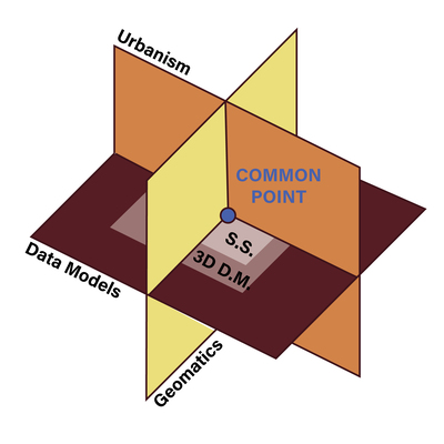
The Common Point: 3D Subsurface Data Models Bridging Geo-Informatics and Urban Design

Research suggests that integrating 3D GIS into urban design and planning enhances realism by closely mirroring human interactions with city elements. Conversely, urban design practices can guide improvements in visualization and analysis methods within 3D GIS. However, existing literature predominantly focuses on above-surface data, neglecting 3D subsurface models crucial for addressing underground challenges like energy transition and water infiltration. This double-degree Master’s thesis in Geomatics and Urbanism explores the potential of 3D subsurface data models to aid sustainable urban design, bridging the gap between Urbanism and Geomatics. The study investigates the compatibility of 3D subsurface data models and their respective standards and interfaces with design requirements, aiming to enhance the integration of Urbanism and Geomatics. The research includes a practical urban design exercise using the Utrecht BARCODE methodology, integrating 3D sustainable design interventions proposed by the BARCODE with a 3D subsurface data model to assess the benefits of this combination.

Supervisors: Peter van Oosterom + Alexander Wandl (Urbanism)
(company involved: Rob Van Der Krogt (TNO))

Bing-Shiuan Tsai
Extending the 3D City Database 5.0 to support CityGML application in QGIS

Semantic 3D city models data management can be achieved in CityGML with database encoding to handle large amounts of data. For CityGML, there is an open source database encoding called the 3DCityDB. The version in use is 4.X, which is derived from the CityGML v.2.0. Except for data storage, it enables users to convert object associations to relations between predefined feature tables based on a mapping rules set consistent to the standard. Although the 3DCityDB was developed to simplify CityGML complexity, it still remains complex for users with basic SQL skills. However, a plugin for QGIS, called “3DCityDB-Tools for QGIS”, is developed to facilitate the interaction with the 3DCityDB for a wider group of practitioners, narrowing the gap between them and the geodata experts via a GUI in QGIS. The OGC has recently published the CityGML v.3.0 in Sep. 2021, and the 3DCityDB is being updated to version 5.0 in order to add full support for CityGML v.3.0. The goal of this research is to investigate how the new database structure of the 3DCityDB v.5.0 can be coupled with the existing 3DCityDB-Tools plugin, in order to enable support not only for the existing version 4.x, but also for the upcoming version 5.0. The research will start from familiarising the mapping structure of the data in both CityGML v.2.0 and v.3.0 to the new schema, performing experiments on the database modification on the server-side, and eventually improving the user experience with the existing QGIS plugin.

Supervisors: Giorgio Agugiaro + Camilo León-Sánchez
(company involved: Claus Nagel, Zhihang Yao)

Qiuxian Wei
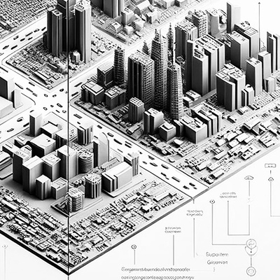
Simplification for 3D city models

3D Tile is one of the approaches to disseminating 3D models on a large scale, which is an open community standard established by the Open Geospatial Consortium (OGC). Given that large-scale 3D models typically demand significant storage space, the effectiveness of these dissemination methods is a pivotal consideration. Utilizing generalization and compression techniques can greatly improve its efficiency.

This study aims to explore a widely applicable method for generalization of 3D models, with an emphasis on reusability. Furthermore, the collaborative integration of compression techniques, such as Draco, Gzip, MeshOpt, etc., with simplification methods will be explored to optimize the overall performance of disseminating 3D models.

To ensure the widespread applicability of this study, open data will serve as the primary data source.

Supervisors: Ken arroyo ohori + Stelios Vitalis
(company involved: Tom Tom -- Stelios Vitalis)

Longxiang Xu
Multi-view consistent line segment detection

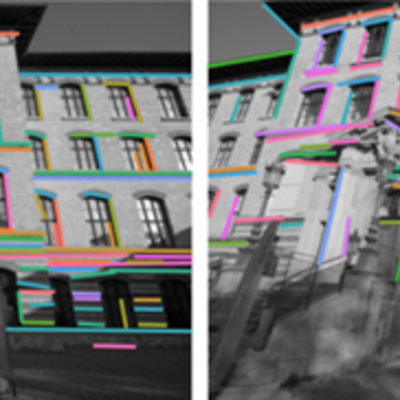
Wireframe parsing in images is focused on extracting the structured layout of a scene, a critical step in creating detailed yet compact building models. Despite its importance, wireframe parsing remains a challenging aspect in the fields of computer vision and 3D reconstruction. Multi-view images, on the other hand, can potentially help decrease the ambiguity of the detection result with the complementary information provided by other images. The thesis aims at proposing a method that leverages the complementary information of multiple views, by enforcing/encouraging multi-view consistency, to improve wireframe parsing outcomes. The potential applications of wireframe parsing, including piecewise segmentation of images and 3D wireframe reconstruction, will also be showcased in this work.

Supervisors: Liangliang Nan + To be determined

chi zhang
Applying Generative Model for Better 3D Reconstruction

Multi-view 2D images serve as crucial inputs or intermediate products for various cutting-edge 3D reconstruction techniques, including MVSnet, Nerf, Gaussian Splatting, and Neus, which aim to recover 3D representations such as point clouds, neural radiance fields, and signed distance functions (SDFs) from multiple perspectives. The quality of these input images significantly influences the performance of downstream 3D reconstruction tasks. Challenges such as textureless surfaces, adverse lighting conditions, and shading effects often lead to a degradation in the accuracy and fidelity of reconstructed 3D models.

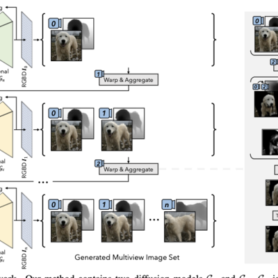
In recent years, the stable Diffusion model has demonstrated considerable success and found widespread application in 3D editing and personalized tasks, exemplified by applications like Magic3D, Dreamfusion, and Dream3D. In this work, we propose leveraging a generative model to enhance 3D reconstruction tasks. Specifically, we employ a stable Diffusion model for image inpainting tasks on input images. Additionally, we introduce our techniques to generate multi-view consistent images from the original input, addressing and mitigating imperfections present in the original images. This includes tasks such as adding texture to texture-less images or introducing shading to poorly illuminated areas.

Our approach aims to demonstrate the effectiveness of employing a stable Diffusion model and 3D cross-attention layers in enhancing the quality of input images for 3D reconstru

Supervisors: Nail Ibrahimli + Liangliang Nan