Thesis starting September 2022

Yuduan Cai

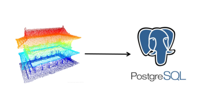
In the field of massive point cloud data management, the majority of point cloud data is currently done at the file level, but an efficient database-based solution is crucial. Database management system (DBMS) has advantages in functionalities, optimised disk IO strategies and automatic parallelization in the query executions. PostgreSQL is a desirable database to store point clouds, as it is open-sourced, has spatial extension and supports arrays for all its scalar types, allowing us to store additional values per point, like intensity and gps time. In some previous studies, the application of space filling curves for point cloud data has been explored and tested, but queries are usually not efficient enough. In this research, the approach is to split the space filling curve key in a head and tail part and make groups of points inside the database based on the head, therefore to make the storage and manipulation more efficient. The expected outcome includes a storage data model, a Python-based data importer and a scientific benchmark. The benchmark will use AHN2 dataset, and be performed on query, add, update and delete.

Supervisors: Martijn Meijers + Peter van Oosterom

Louis Dechamps

In the past decade, there has been growing interest in creating what is known as a Digital twin of urban environments. This Digital twin is an exact digital representation of the real world and all its physical attributes and relationships and dynamic phenomena. This includes services such utility networks, charged with the transportation of goods such as electricity, data, water, gas, sewage and other commodities that help a city function. In these utility networks it is important for them to be accessible for maintenance reasons, or to remove and replace them completely. The maintenance of these networks can become problematic when the exact (2D, but actually 3D) geographic position of each individual utility type is not known or poorly documented. An accident while accessing the networks can not only be harmful on site but it may also affect the resources supplied to important buildings, such as electricity to a hospital, causing therefore potentially harmful cascading effects. Therefore, it is important that the exact position of utility networks is replicated within the Digital twin? Therefore, the objective of this thesis will be to research the possible ways to improve the utility networks, with particular focus on the geographical information, and special focus on the 3rd dimension. One promising method is to attempt to retrieve the positions of the underground utilities from what are known as 鈥榩it scans’. 1500 char. max

Supervisors: Giorgio Agugiaro + Jantien Stoter

Zhang Fengyan

Geometric algorithms are usually described and designed for infinite precision. However, this is not the case when it comes to the implementation because of floating-point arithmetic, which will cause problems when robust solutions are desired. A common solution is to generate objects with finite-precision estimated coordinates. Iterated snap rounding (ISR) is such a method to convert infinite-precision to finite-precision, so as to obtain well separated vertices and cleaner geometric arrangements. Currently there are some implementations, for example - CGAL. It is robust but there seems to be room for improvement in efficiency. For instance, for a map of the USA (containing about 56 polygons), the average run time is about 78.64s. This is slow in practice (where datasets typically contain thousands of polygons). Related to this, Constrained Delaunay Triangulation (CDT) has been previously used for repairing polygons (prepair) and planar partitions (pprepair), which gives the inspiration to apply CDT on snap rounding process. The aim of this thesis is to explore the possibility of using CDT to perform further optimization. CDT will firstly be constructed as the base data structure, the topological relationships of the triangles will allow to identify the situations where snap is desired. Then the snap operation can be realized by modifying the CDT (e.g., collapsing a particularly thin triangle into a point or an edge), which may be theoretically more efficient.

Supervisors: Ken Arroyo Ohori + Hugo Ledoux

Maren Hengelmolen

Air flows have an impact on the living comfort within the urban environment. Analysing these air flows helps to evaluate the air quality (e.g. natural ventilation, air pollution), and avoid architectural design issues caused by wind loads. Therefore, computation fluid dynamics (CFD) simulations are essential. CFD use mathematics, physics and computer science to simulate and visualise fluid flows. However, CFD simulations require many pre-run set-up features that can drastically affect the performance of the simulation.

To ensure the users simulate real conditions, the wind engineering community has created CFD guidelines. Currently, the users need to implement the pre-run settings manually. Yet some pre-run processes can be partially automated, as well as their comparison with the CFD guidelines. Hence a tool can be developed that performs these functions and can be integrated into a web application for accessibility and usability.

The aim of this project is to create a web application that allows users to import CFD set-ups and verify their compatibility with the most recent CFD guidelines developed by the wind engineering community.

Supervisors: Clara Garcia Sanchez + Hugo Ledoux

Leo Kan

The ICESat-2, which has near global coverage, measures elevation with lidar. There are, however, large data gaps between each track and beam per direction in the spaceborne lidar dataset.

Such gaps are even more prominent at the equator. This project seeks to fill these gaps and derive a Digital Terrain Model (DTM) by a combination of feature extraction, spatial interpolation and machine learning techniques. Auxiliary data from global DEMs such as SRTM, ALOS, or Copernicus DEM will also be needed, and Generative Adversarial Network (GAN) will be the primary method.

The desired goal is to generate a DTM that has good accuracy. The generated DTM will be compared against existing aerial lidar DTMs as ground truth. The extent of this project will, therefore, be approximately the size of existing aerial lidar datasets. Consequently, this project can potentially be helpful when flying an aeroplane is impractical in remote parts of the world.

Supervisors: Hugo Ledoux + Maarten Pronk

Tendai Mbwanda

Semantic 3d city models are an asset to various user groups which require them for storing and using domain-specific urban information. Users want to be able to manipulate and visualise 3d city models. However, the 3DCityDB has a complex structure, sometimes resulting in SQL queries which may be too complex for users with limited SQL knowledge. Hence a QGIS plugin was developed in a previous MSc thesis to “facilitate the use of 3DCityDB for users of different fields and expertise with the common denominator being the well-accustomed QGIS environment” (Pantelios, 2022). However, in it’s current release the 3DCityDB-Loader does not yet support ADEs and has some functional limitations, leaving room for further development. On this background, my thesis will be undertaken to achieve the following objectives: 1. enhance the 3DCityDB-Loader’s functionalities in terms of user experience, for example client-side GUI improvements; 2. develop ADE support on the 3DCityDB-Loader, both client-side and server-side. Further development of the 3DCityDB-Loader will follow incremental and iterative development approaches. In addition, development testing will be performed concurrently for units and components. While the aim is to have a generic approach for ADE support, my focus will be on the Energy ADE.

Supervisors: Giorgio Agugiaro + Camilo Leon-Sanchez

Siebren Meines

With increasing weather extremities due to climate change, and the densification of our urban areas, the need to consider environmental factors such as noise and light become increasingly important. To consider all these aspects, a change in the way we design our urban areas in necessary. Historically decisions in urban development are often made with the idea of optimization based on a certain environmental factor, without factual backing. For instance: a building is made in a certain shape, to maximize the amount of sunlight coming into the building, but instead of running simulations such a decision is often made solely on a hunch. Recently there has been a development to aim to make these decisions more grounded for instance with parametric design. Although this is a step in the right direction, there are many improvements to be made. In my thesis I will develop a game engine based spatial decision support system (SDSS) for urban development design. The tool aims to provide urban developers an easy, scientific, and comprehensible tool which they can use to make spatial decisions considering different criteria such as daylight and noise. The tool will combine urban decision-making with GIS analysis. The efficient use of geospatial data and GIS functions will support a scalable architecture for urban development. the A game engine will be used to make the tool interactive, to be able to quickly (re)calculate spatial analysis, and to make it fit for VR.

Supervisors: Azarakhsh Rafiee + Eleonora Brembilla

Ioanna Panagiotidou

Multi-view stereo (MVS) allows us to reconstruct a dense 3D representation of scenes based on a visual set of overlapping images. The most common reconstruction pipeline of MVS establishes dense correspondences between images to obtain depth maps. Traditional MVS methods that rely on photo-consistent metrics to establish these correspondences achieve remarkably accurate results, yet are weak on producing a complete model reconstruction. This is because reflective, low-textured and specular regions of the image make matching impossible, leading to invalid depth pixel estimates. To address this issue, various researchers have included global semantic data in their methods. By using nearby pixels from the same object class, they explored ways to refine depth maps. For example, they assumed that pixels that belong to the same semantic region must share an identical depth value. The built environment, which is the focal point of this thesis, typically consists of planar surfaces. During reconstruction, such semantic priors that enforce strong geometric constraints specific to each class help to achieve better completeness results. Another way that researchers have addressed the incomplete model reconstruction is by implementing learning-based MVS systems. In recent years, these systems have demonstrated superior performance by surpassing the traditional approaches in stereo benchmarks. This research aims to reconstruct a complete and accurate representation of building facade ele

Supervisors: Nail Ibrahimli + Hugo Ledoux

Chrysanthi Papadimitriou

A geodata ecosystem consists of data from a wide variety of stakeholders from public, private, academia, and other sectors and each of them contributes to the ecosystem with different levels of openness. However, the majority of annually created data, are controlled by companies and not easily accessible or reusable for other stakeholders. The European Commission is trying to address the fragmentation of data between stakeholders by introducing the concept of Data Spaces, in an attempt to connect dispersed geographical data from different actors, from the private and public sectors. One of the objectives of the EU Green Deal Data Space is to create a sustainable governance scheme that connects national, regional, and local data ecosystems and enables public and private stakeholders to access relevant data and to develop cross-sector data services to address the challenges the EU Green Deal brings, such us making Europe climate-neutral and ensuring a just and inclusive transition. This thesis will contribute to this objective by exploring the barriers and incentives for the private sector to participate in the Green Deal Data Space. Additionally a strategy will be designed to satisfy these requirements. The requirements will be developed by qualitative research from surveys and interviews with private companies that would potentially be part of the data space.

Supervisors: Bastiaan van Loenen + Stefano Calzati

Chris Poon

The 3DBAG contains the geometries of buildings for the whole Netherlands. The scope of this thesis is to infer the building type using as main sources the 3DBAG and the BAG datasets using feature engineering as well as machine learning.

Recent studies such as 3D Building Metrics or Global Building Morphology Indicators calculate some metrics from buildings that could potentially be used as features for a ML algorithm. Can these types of metrics correctly classify the building type? In this thesis, the student is expected to use the open data available in the Netherlands to extract features that can lead to infer the building type of a construction based on the TABULA project specification for the NL.

The building type information plays a relevant role for energy simulation tools since they can be used to overcome the lack of data of the 3DBAG regarding building physics such as construction materials.

Supervisors: Camilo Leon-Sanchez + Giorgio Agugiaro

Leon Piotr Powałka

Creating GPS art on the map is an interesting way to make one’s outdoor activity more engaging. Cyclists, runners and hikers can create impressive drawings on the map by traversing the road/pedestrian network in a carefully planned way. Such planning, however, is not yet automated, which makes the GPS artists have to meticulously design the routes with the complex road network in mind. The aim of my research is to come up with a full process that can express a person’s initial idea (for example a contour drawing) as a route, which the user can then follow to create their GPS art. This involves transforming the input image to match the routing network in a selected area and generating a route which approximates the shape in the best possible way. For the first part, an image matching algorithm can be used to search for patterns in the road network. The second part will use a graph routing algorithm with a custom cost function to make the resulting route as similar to the input shape as possible.

Supervisors: Liangliang Nan + Jantien Stoter

Eleni Theodoridou

Modern cities are complex entities that require innovative solutions in order to face pressing challenges and add economic and social value to their assets. A powerful tool to assist urban planners and decision makers in city management, achieving sustainability and tackling environmental and socio-economic issues, are urban digital twins. An urban digital twin replicates the real - world 3D built environment with the addition of smart city and Internet of Things (IoT) technologies, such as sensors, that update this digital platform in accordance with the real - life processes and functions. Therefore, sensor data input is the crucial factor that transforms a static 3D city model to a dynamic urban digital twin. A main issue that needs to be addressed in present-day digital twins is the lack of standardization and interoperability. Therefore, in this research, an attempt will be made to facilitate both of the aforementioned aspects in an urban digital twin by using widely accepted standards such as OGC SensorThingsAPI and OGC 3D Tile standard to integrate sensor measurements into a 3D city model platform. The main objectives of this research are (1) the integration of diverse sensors, (2) real - time visualization of the sensor data, and (3) using the data for urban simulations and pattern analysis.

Supervisors: Dr. Azarakhsh Rafiee + Dr. Martijn Meijers

Adele Marie Therias

Ghana and Cote d’Ivoire are major producers and exporters of cocoa beans. In recent years, environmental and social factors have led smallholder farmers to encroach onto forest land. As of 2024, the European Union will ban the import of such products issued from deforested areas, a law whose enforcement will require highly accurate and timely tracking of farm extents. While the classification of multispectral satellite imagery is applied to detect other crops, cocoa presents unique challenges. First, West Africa has frequent cloud cover due to Monsoon climate, limiting the availability of cloud-free multispectral datasets and the temporal resolution of datasets. Second, agroforestry, which integrates shade trees to improve cocoa growing conditions, has a spectral signature and canopy structure similar to nearby forest. To address these challenges, researchers have implemented machine learning algorithms trained with radar, multispectral, or a combination of both, to identify cocoa crops. While most of these implementations use a pixel-wise classification that does not consider the spatial context, recent work has applied a Convolutional Neural Network trained with multispectral data that shows promising results in Ghana and Cote d’Ivoire. The objective of this thesis is to build on this research by integrating radar data into the network in order to test the impact of texture information on the accuracy of the deep learning classification.

Supervisors: Dr. Azarakhsh Rafiee + Dr. Stef Lhermitte

Fabian Visser

Arguably, two of the most interesting fields in machine learning right now is the development of differentiable 3d reconstruction, and stylistic rendering. Implicit Differentiable Rendering (IDR) recreates 3d geometry, camera parameters, and color and reflectance of the object, requiring only masked images as input. The geometry is modeled using the zero level set of a NN, and the material using a neural renderer. The renderer of two different models can be swapped to create geometry from one scene with appearance from the other. Stylistic rendering is all about applying styling, artistic characteristics, to a scene. Style representation correlates features between different layers of a CNN, which can be used to reconstruct styling while keeping content representation from another input image. If it possible to swap renderers for IDR, is it then possible to instead introduce a stylistic renderer? That is the question that I will be exploring. Something similar has been performed for NeRF, applying styling to the view synthesis created. I will explore if a similar method be implemented to IDR, either as a renderer or to the ouput images. It could also be possible to look at texture mapping the styling. To simplify the process, fast style transfer can be used, which only requires one forward pass for the content reconstruction.

Supervisors: Nail Ibrahimli + Liangliang Nan

Yitong Xia

The objective of this research is to extract openings (including doors and windows) of buildings using image data sources (oblique aerial imagery or street view images) and integrate them into the 3D BAG LoD 2.2 building model. To identify the building façades, doors, and windows information in the images, machine learning techniques will be used. After correcting the extracted facade and calculating the relative position of openings on the facade, the 3D coordinates of openings will be calculated by combining the 3D coordinates of the corresponding facade and finally integrating them into the 3D BAG. The openings can be placed almost exactly on the plane of the façade due to the approach used to derive 3D absolute position from 2D relative position. The solution could be easily extended to very large area (e.g. the whole Netherlands) due to the image data coverage is large and easily accessible. The expected results of t his project are a program to automate the integration of windows and doors with 3D BAG LoD 2.2 model, capable of handling a wide range of complex buildings and façades.

Supervisors: Jantien Stoter + Weixiao Gao

Lan Yan

With the rapid development of information technologies, the Architecture, engineering, and construction industry (AEC) face the opportunities and challenges that they bring, for example, the coming into being of building information modeling (BIM). The Industry Foundation Classes (IFC) is considered the most-used data exchange format for BIM models. However, the IFC is complex, and thus creates difficulties in extracting meaningful information from IFC models when using them for different user applications. Therefore, it is necessary to develop software tools that can extract information from BIM models based on customers’ needs.

In many applications within the AEC industry, users only need the exterior shapes of buildings, for instance issuing building permits, or conducting building energy simulations. Under these circumstances, directly using the IFC models can bring unnecessary information and slow down the process. Therefore, this graduation project will aim at building a software tool that can extract the building exteriors from input IFC models. The feature extraction process of this software will follow a mixed approach between generalized 3D shape extraction algorithm (for example 3D alpha shapes) and shape extraction with a focus on building models to preserve buildings’ semantic information (for instance which part belongs to the roof part and which part belongs to the wall part).

Supervisors: Ken Arroyo Ohori + Jasper van der Vaart

Yue Yang

The aim of this study is to improve an LADM 3D prototype system on the example of selected city districts. In land administration, 3D data visualisation is needed in many cases to represent the real world. Cesium is widely used to display 3D data that is more complicated than 2D. However, when there are millions of buildings, it takes a long time to retrieve and load the data. The research revolves around the possibility of storing both geometries and attributes in a database. To achieve this approach, the data will be sent to the client via a server dealing with 3D geospatial data. This proposed method would possibly speed up loading time and interaction. Literature research on geometry representation and render object triangulation will be conducted, also GeoWeb and existing applications such as 3DCityDB web map client and 3D BAG viewer. Based on this, efficient indexing of spatial data will be studied, such as R-tree, which helps retrieve data from the database faster. Methodologies and libraries related to theories above will be explored in practice. It is also expected to avoid potential problems such as data redundancy, data inconsistency and error. In addition, vario-scale will also be studied, possibly implementing aggregation when zooming out and in. Also worth noting the semantic information can be ambiguous due to the legal meaning of spatial plans. To validate the proposed system architecture, the improved prototype will be compared with the previous version.

Supervisors: Martijn Meijers + Peter van Oosterom

Marieke van Esch

Driving Urban Transition (DUT) is a co-funded European partnership addressing urgently needed urban transformations towards a sustainable future with enhanced quality of life in cities (DUT, 2022). One of the three topics they are addressing is the 15-minute cities (15mC). Sustainable mobilities will be promoted for 15-minute reachable destinations. With the reorganisation of daily route mobilities and redistribution of urban space configuration, it will be possible to make our cities more climate neutral, healthier and inclusive. Several cities developed their own walkability tools based on quantitative measurements (based on the proximity of facilities for example) in order to evaluate their streets. For now, they don’t take into account the experience/perception of pedestrians with increasing temperatures and humidity whilst walking through cities. The question for the Geomatics part is: how to model the pedestrian perception in streets with the increase of temperature and change in humidity within cities in 2050? This will be done by QGIS, SQL and 3DBag. The question for the Urbanism part is: how to arrange climate adaptive public spaces in favour of (denser) healthier population cities in 15mC? The formulation of this IDD thesis is still evolving. The test case is still to be determined: Right now Amsterdam, The Hague or Utrecht are options. Gert-Jan Steeneveld of Wageningen University for temperature increases in 2050 and Simon Schneider of Utrecht University.

Supervisors: Edward Verbree + Stefan van der Spek